
Forecasting Weather
Learning Objectives
Know the reliability of weather forecasts with 5-, 7- and 10-day windows.
Know what satellites and models are used for, and how they’re combined to make a forecast.
What is weather forecasting?
Weather forecasting is the application of current technology and science to predict the state of the atmosphere at a given time and place in the future. Weather forecasts are made by collecting as much data as possible on current atmospheric conditions (especially temperature, humidity and wind) and using knowledge of atmospheric processes (through meteorology) to determine how the atmosphere will evolve in the future.
Reliability of weather forecasting
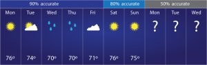
With the development of modern technology, the reliability of weather forecasting is very high today. Weather forecasts can give you a good idea of what to expect. A seven-day forecast can accurately predict about 80 percent of the weather, while a five-day forecast can accurately predict about 90 percent of the weather. But if more than seven-day forecast the accurate will be lower because the atmosphere is changing constantly.
How to forecast weather
Some of the information needed to make weather forecasts comes from environmental satellites. The national oceanic and atmospheric administration (NOAA) operates three types of environmental satellites to monitor the earth’s weather.
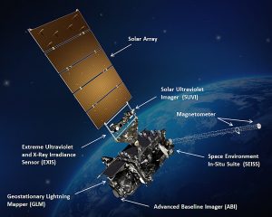
1. Geostationary satellites: NOAA’s geostationary environmental operations satellite-r (goes-r) series of satellites, which orbit about 22,000 miles above earth, provide pictures of current weather conditions. Geostationary means that the satellite rotates at the same speed as the earth. This means they can collect nearly continuous images in the same area. Because they are focused on one location, they can provide up-to-date information about severe weather. This information helps forecasters understand the growth and speed of hurricanes, such as hurricanes.
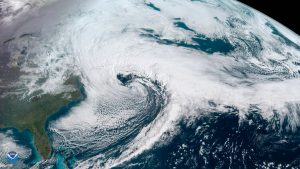
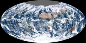
2. Polar-orbiting satellite: a satellite that orbits the earth for about 500 miles as part of NOAA’s joint polar satellite system (JPSS). They slide from pole to pole 14 times a day on our planet. Because they orbit below the earth’s rotation, these satellites can see every part of the earth twice a day. Polar-orbiting satellites can monitor the entire earth’s atmosphere, clouds and oceans at high resolution. By observing these global weather patterns, polar-orbiting satellites can help meteorologists accurately predict long-term forecasts – up to seven days in the future.
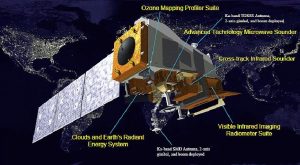
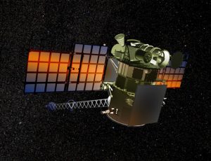
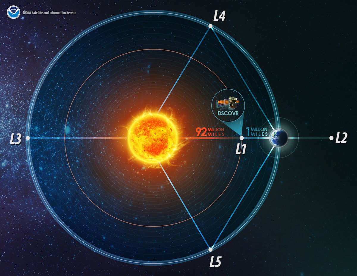
3. Deep space satellite: NOAA’s deep space climate observatory (DSCOVR) orbits the earth for a million miles. It provides space weather warnings and forecasts, as well as monitoring the amount of solar energy the earth absorbs each day. DSCOVR also looks at ozone and aerosols in the earth’s atmosphere. These factors are important for the prediction of air quality.
The condition of being in sync with earth's rotation
